20’000 historische Karten unter CC0
New York Public Library
Die NYPL veröffentlicht 20’000 historische & hochauflösende Karten unter CC0. Sie können mit dem NYPL Map Warper betrachtet und editiert werden (siehe unten – Youtube Tutorial). Zudem kann man sie auch als KML-Dateien herunterladen und direkt in Google Earth anschauen.
The Lionel Pincus & Princess Firyal Map Division is very proud to announce the release of more than 20,000 cartographic works as high resolution downloads. We believe these maps have no known US copyright restrictions.* To the extent that some jurisdictions grant NYPL an additional copyright in the digital reproductions of these maps, NYPL is distributing these images under a Creative Commons CC0 1.0 Universal Public Domain Dedication.
Regionen
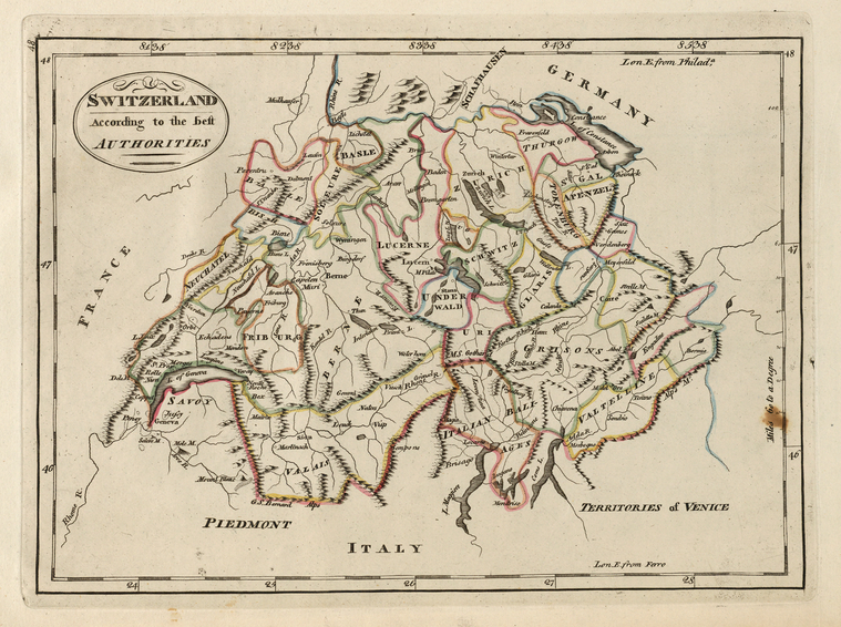
Die Karten zeigen mehrheitlich Regionen in den USA wie z.B. Kalifornien im Jahr 1860 oder alte Stadtpläne von New York. Es sind aber auch historische Karten aus Europa zu finden – hier z.B. die Schweiz im Jahr 1814.